
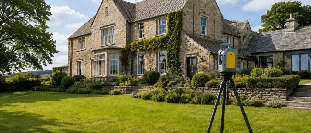
A measured building survey creates an accurate record of an existing property’s dimensions, layout and visible architectural features.
The resulting floor plans, elevations and sections give architects, engineers and property professionals reliable information for planning refurbishments, extensions, conversions and redevelopment projects.
This guide explains what the survey includes, how it is carried out, which drawings can be produced and what affects the cost.
What Is a Measured Building Survey?
The survey records the size, position and relationship of the building’s main structural and architectural features. The information collected can then be used to prepare accurate 2D CAD drawings, registered point cloud data or three-dimensional models where required.
A measured building survey may record:
- External and internal walls
- Floor layouts and ceiling heights
- Doors and windows
- Columns, beams and structural openings
- Staircases and changes in level
- Roof structures and roof features
- Fixtures and architectural details
- External and internal elevations
- Floor levels and survey datums
The exact content depends on the property, the purpose of the survey and the level of detail required by the project team.
Measured building surveys can be completed on almost any type of property, including houses, apartment buildings, offices, shops, warehouses, factories, schools, hotels, listed buildings and historic properties.
What Does a Measured Building Survey Include?
A measured building survey can include several different types of drawing. A clear survey brief should identify which drawings are required and the level of detail they need to contain.
The most common deliverables are measured floor plans, external elevations and building sections. Roof plans, reflected ceiling plans and internal elevations can also be produced where required.
Measured Floor Plans
A measured floor plan shows the internal arrangement of a building from an overhead perspective.
The drawing records the position and thickness of walls together with structural and architectural features such as:
- Doors and windows
- Columns and beams
- Staircases
- Built-in cupboards
- Sanitary fittings
- Kitchen fittings
- Fireplaces
- Changes in floor level
Additional information may include room names, floor levels, ceiling heights, wall dimensions and notes describing important features.
Floor plans can be prepared for an entire building, an individual floor, a specific part of a property or a single room.
Where a building has several storeys, each level is normally shown on a separate drawing. The plans can be aligned within CAD software to help the design team understand how walls, openings and structural features relate between floors.
Measured floor plans are commonly produced at scales between 1:50 and 1:200, depending on the size of the building and the amount of detail required.
External Elevations
An external elevation is a scaled, two-dimensional representation of one side of a building.
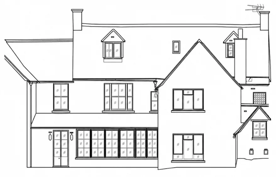
Elevation drawings show the shape and appearance of the building façade without perspective distortion. They are commonly labelled according to their orientation, such as north, south, east and west.
A measured elevation may show:
- The building outline
- Doors and windows
- Rooflines, ridges and eaves
- Chimneys
- Rainwater pipes and drainage features
- External steps and changes in level
- Architectural details
- Changes in external materials
- Survey levels and datums
- Overall heights and dimensions
External elevations are frequently required for planning applications, extensions, façade alterations, refurbishment projects and heritage work.
Internal Elevations
Internal elevations show a vertical view of the inside face of a wall.
They are useful where the internal appearance of a room is important or where a significant amount of architectural detail needs to be recorded.
Internal elevations may be required for:
- Listed and historic buildings
- Hotels and hospitality properties
- Retail fit-outs
- Kitchens and bathrooms
- Decorative interiors
- Rooms containing panelling, fireplaces or mouldings
- Complex mechanical and electrical installations
Large heritage buildings may require detailed internal elevations to record decorative features and historically significant interior fabric.
Building Cross-Sections
A building cross-section shows a vertical view through a property, as though the structure has been cut along an imaginary line.
Sections help architects and designers understand the relationship between different floors, roof spaces and internal areas that may not be clear from the floor plans alone.
A measured building section may show:
- Floor-to-floor heights
- Ceiling heights
- Roof profiles
- Staircases
- Structural beams
- Changes in level
- Wall, floor and roof relationships
- Below-ground areas where visible and included within the brief
Cross-sections are particularly valuable for buildings with several storeys, split levels, complex roofs or significant changes in height.
Measured Roof Plans
A measured roof plan shows the form and layout of a building’s roof from above.
Depending on the project requirements, a roof plan may include:
- Roof ridges and valleys
- Hips and verges
- Parapets
- Chimneys
- Rooflights and skylights
- Gutters and drainage outlets
- Plant and ventilation equipment
- Access hatches
- Satellite or communications equipment
Many roofs can be recorded using terrestrial 3D laser scanning. Where parts of the roof cannot be seen clearly from ground level, an aerial drone survey may be used to capture additional information from above, subject to the location, site conditions and applicable flight restrictions.
Combining terrestrial laser scanning with aerial survey data can provide more complete coverage of complex or inaccessible roof structures.
Reflected Ceiling Plans
A reflected ceiling plan records the layout of a ceiling as though it were viewed from above.
These drawings are often used for refurbishment, interior design, heritage recording and mechanical or electrical design.
A reflected ceiling plan may show:
- Lighting positions
- Ceiling beams
- Ventilation grilles
- Sprinklers
- Pipes and services
- Ceiling panels
- Decorative mouldings
- Coving
- Access panels
- Changes in ceiling height
The amount of information shown depends on the visibility of the ceiling and the agreed level of detail.
When Is a Measured Building Survey Needed?
A measured building survey is normally commissioned when reliable existing drawings are unavailable, incomplete or no longer reflect the current layout of the property.
A survey may be required for:
- Building extensions
- Property refurbishments
- Planning applications
- Change-of-use projects
- Interior design and fit-out work
- Listed building applications
- Heritage recording
- Space planning
- Redevelopment and conversion projects
- Building Information Modelling
- Asset and facilities management
- Fire safety and access planning
Older drawings should not automatically be assumed to represent a building accurately. Properties are frequently altered over time, and original construction drawings may not record later extensions, internal changes or replacement features.
A new measured building survey gives the project team an up-to-date record of the property as it existed on the date of the survey.
Who Uses Measured Building Survey Drawings?
Measured survey drawings are used by a wide range of construction and property professionals, including:
- Architects
- Structural engineers
- Building surveyors
- Planning consultants
- Interior designers
- Property developers
- Heritage consultants
- Facilities managers
- Contractors
- Mechanical and electrical engineers
The drawings provide a common reference point that allows different members of the project team to work from the same measured information.
How Is a Measured Building Survey Carried Out?
Measured building surveys can be completed using a combination of 3D laser scanning, total station observations, manual measurements and photography.
The most suitable method depends on the size and complexity of the building, the accuracy required and the final survey deliverables.
1. Reviewing the Survey Brief
Before attending the property, the surveyor reviews the project requirements.
The brief should confirm:
- The areas to be surveyed
- The drawings required
- The requested level of detail
- The proposed drawing scale
- The required file formats
- Whether survey levels or coordinates are needed
- Whether inaccessible areas need to be included
- Any access, operational or safety restrictions
A clear brief helps ensure the completed drawings contain the information required by the design team.
2. Surveying the Building
The surveyor records the exterior and interior of the property.
A 3D laser scanner can capture millions of accurately positioned points across visible surfaces. These points form a three-dimensional point cloud representing the shape and position of the building.
Several scan positions are normally required to record separate rooms, floors and external façades. The individual scans are then connected to produce a coordinated dataset.
Manual measurements and photographs may also be taken to record features that require clarification or cannot be captured clearly by scanning alone.
3. Processing the Survey Data
After the site survey, the scan data is registered and checked.
The resulting point cloud provides a measurable three-dimensional record of the building. Survey technicians use this information to extract dimensions and prepare the required drawings.
Quality checks are carried out to identify missing areas, inconsistencies or features requiring further interpretation.
4. Producing the Survey Drawings
The measured survey data is converted into floor plans, elevations, sections and any other agreed outputs.
Completed drawings and survey data may be supplied in formats such as:
- DWG
- DXF
- E57
- LAS
- Other recognised point cloud formats
- 3D model formats where agreed
The required software version, file format, drawing scale and presentation standard should be confirmed before production begins.
What Level of Detail Is Required?
Not every project requires the same level of detail.
A basic floor plan for early feasibility work may only need walls, openings and key dimensions. A detailed refurbishment or heritage project may require fixtures, mouldings, services, structural features and changes in materials to be recorded.
Higher levels of detail require more time both on site and during the production of the drawings.
Before requesting a quotation, it helps to provide:
- Existing plans or property information
- The full site address
- The approximate building size
- The number of floors
- Photographs of the property
- A marked-up plan showing the survey area
- A list of the drawings required
- The preferred scale and file format
- The intended use of the survey
This information allows the survey company to understand the scope of work and provide a more accurate fee proposal.
Survey accuracy, drawing scale, coordinate control and the required deliverables should be clearly defined within the project brief. The RICS publication Measured Surveys of Land, Buildings and Utilities provides recognised guidance on the specification and production of measured survey information.
Benefits of a Measured Building Survey
Accurate Existing-Building Information
A measured building survey provides an accurate record of a property’s current dimensions, layout and visible features.
This gives the design team a more dependable starting point than old, incomplete or unverified drawings.
More Informed Design Decisions
Architects and engineers can use the survey drawings to assess the existing building and develop proposals that respond to its actual dimensions and physical constraints.
Reduced Risk of Design Conflicts
Accurate survey information can help identify unusual wall positions, changes in level, restricted spaces and other physical constraints before detailed design or construction begins.
Although no survey can eliminate every project risk, reliable existing-building information reduces the need to make assumptions.
Better Project Coordination
Floor plans, elevations, sections and point cloud data allow different consultants to work from a consistent set of information.
This can improve coordination between architectural, structural and building-services designs.
A Permanent Digital Record
The completed survey provides a digital record of the building at a particular point in time.
This can be useful for future refurbishment, maintenance, asset management or heritage purposes.
How Much Does a Measured Building Survey Cost?
There is no fixed price for a measured building survey because every building and project is different.
The cost is usually affected by:
- The size of the building
- The number of floors
- The complexity of the layout
- The type and number of drawings required
- The requested level of detail
- The amount of internal and external access available
- The condition and use of the property
- The required accuracy
- The location of the site
- The required turnaround time
- Whether point cloud data or a 3D model is required
A small residential property requiring floor plans will usually cost less than a large commercial, industrial or historic building requiring detailed floor plans, elevations, sections and roof information.
The most reliable way to establish the cost is to provide the survey company with a clear brief and as much information about the property as possible.
How Long Does a Measured Building Survey Take?
The timescale depends on the size and complexity of the building and the number of drawings required.
The work includes both the site survey and the production of the drawings. For larger or more detailed projects, drawing production can require considerably more time than the site visit itself.
Access restrictions, occupied rooms, complex architectural details and incomplete visibility of the roof can also affect the programme.
The required delivery date should therefore be discussed when requesting a quotation.
Does a Measured Building Survey Include a Structural Assessment?
A measured building survey records the dimensions and visible features of a property. It does not normally assess the structural condition of the building.
Structural inspections should be carried out by a suitably qualified structural engineer or building surveyor.
Measured survey drawings can, however, provide the base information those professionals need for their assessment and design work.
Do I Need a Survey If Existing Drawings Are Available?
Existing drawings may be useful, but they should be checked before being relied upon.
They may be outdated, incomplete or based on the original design rather than the building as constructed. Later extensions, internal alterations and replacement features may also be missing.
Where accurate dimensions are important, a measured survey can verify the current building and provide an up-to-date set of drawings.
Measured Building Surveys from Pinpoint Mapping
Pinpoint Mapping provides professional measured building survey services for residential, commercial, industrial and historic properties across Bristol, Bath and the South West.
Our surveyors use professional 3D laser scanning and surveying equipment to capture buildings accurately, both internally and externally.
Depending on the project brief, we can provide:
- Measured floor plans
- External elevations
- Internal elevations
- Building sections
- Roof plans
- Reflected ceiling plans
- 2D CAD survey drawings
- Registered point cloud data
- Additional survey outputs by agreement
Each survey is planned around the needs of the individual project rather than using a standard one-size-fits-all specification.
Request a Measured Building Survey Quotation
To request a quotation, provide as much information as possible about the property and the drawings you require.
Useful information includes the site address, approximate floor area, number of storeys, photographs, existing plans and a description of the proposed project.
Contact Pinpoint Mapping by telephone or email, or use the Request a Quote form on our website. We will review the information and provide a clear quotation based on the required survey scope.