
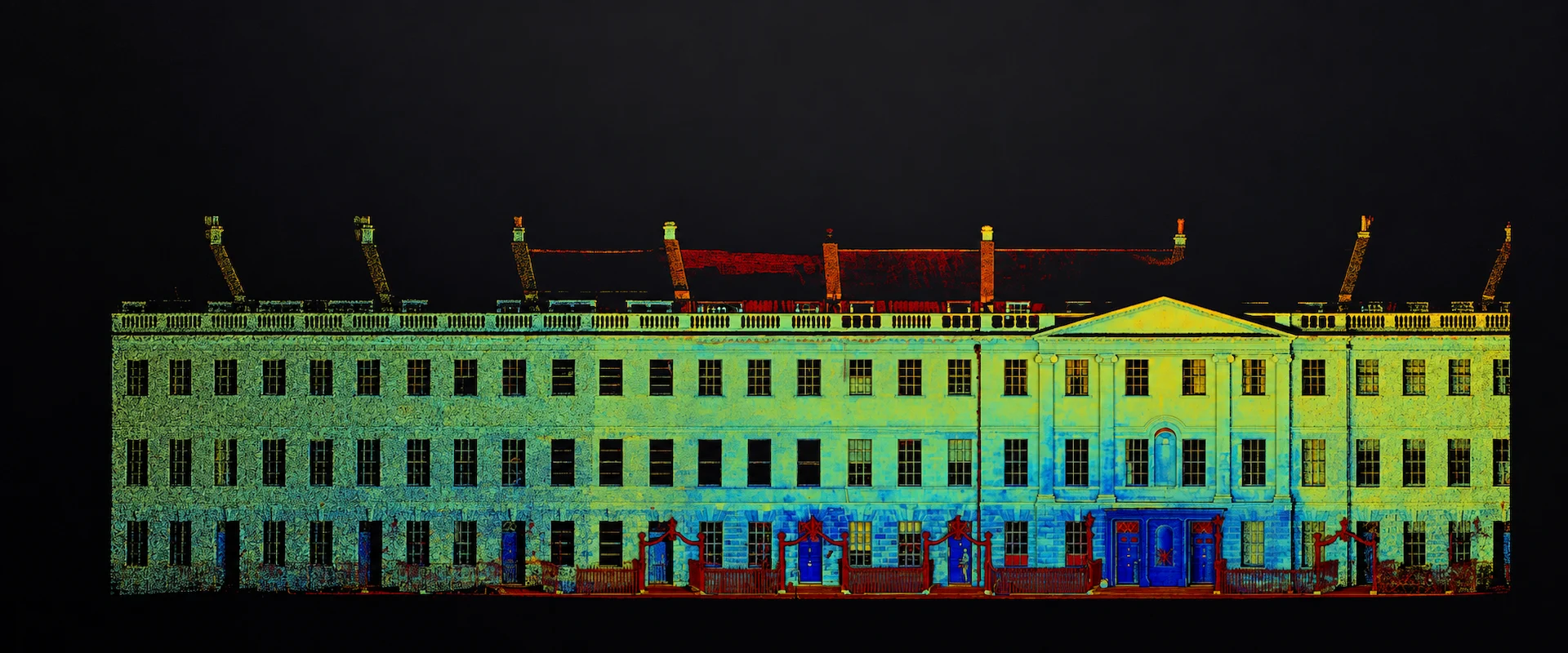
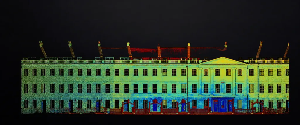
Registered 3D Point Cloud Data for Your Project
Pinpoint Mapping supplies registered 3D point cloud data in Bristol, Bath and across the South West for survey, CAD, engineering, design and BIM workflows.
A 3D point cloud is a detailed digital representation of a building, site or structure. Millions of individually measured points are captured using survey-grade laser scanning equipment and registered together to reproduce the visible position, shape and geometry of the surveyed area.
Our point cloud data service is suitable for surveyors, architects, engineers, CAD technicians, contractors and BIM teams that want to inspect measured data or produce their own drawings, models and specialist project outputs.
The survey can include internal rooms, external elevations, accessible roof structures, surrounding land, exposed structural elements, industrial areas and other visible features agreed within the project brief.
Where completed drawings are required, the same captured data can support our measured building surveys. More information about site capture is available on our 3D laser scanning page.
Point Cloud File Formats
Point cloud file formats can be exported from the Trimble T10+ tablet and Trimble RealWorks survey software to suit a range of compatible workflows. The correct option depends on the receiving software, whether scan-station structure must be retained and how your team intends to use the data.
TDX
Trimble TDX project data for compatible Trimble survey and point cloud workflows where the receiving team wants to continue processing or reviewing the project.
TZF
Trimble TZF scan data for compatible Trimble processing workflows where structured scan information is required.
E57 Gridded Files
Gridded E57 files can retain the individual scan-station structure for compatible survey, CAD, engineering and BIM software.
E57 Single Non-Gridded File
A single non-gridded E57 file can combine the registered point cloud into one dataset where individual gridded scan positions are not required.
PTX File
PTX data can be supplied for compatible software workflows where structured scan-station information is required.
LAS 1.2
LAS 1.2 point cloud data can be supplied where this version is required by the receiving geospatial, survey or processing software.
LAS 1.4
LAS 1.4 point cloud data can be supplied where this later LAS version is required by the client’s software or project workflow.
POD
POD point cloud data can be exported for compatible software workflows where this format has been specified by the receiving project team.
Autodesk RCP
Autodesk RCP data can be supplied for compatible Autodesk point cloud, CAD and modelling workflows.
Please confirm the receiving software, software version, required file structure and intended use before the survey is commissioned. This allows the data to be registered and exported in the most suitable format for your project.
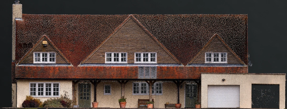
Need 3D Point Cloud Data for Your Project?
Send us the site location, required survey coverage, receiving software and preferred point cloud format, and we’ll advise on the appropriate survey scope, registration workflow and deliverables.
Request a Survey QuotationSubcontract Laser Scanning for Survey Companies
Pinpoint Mapping provides flexible 3D laser scanning and point cloud data support when another survey practice needs additional site capacity, specialist equipment or regional coverage.
Site Capture Without Unnecessary Additional Services
Our role can be limited to site attendance, 3D laser scanning, registration and delivery of the agreed 3D point cloud data files.
The commissioning survey company can complete its own CAD production, modelling, calculations, quality checks and client delivery. Finished drawings or models are only included where they have been specifically requested and quoted.
This allows survey practices to increase capacity without purchasing additional scanning equipment, employing further field staff or outsourcing the entire project workflow.
Subcontract Support Can Include
- Additional capacity for large or time-sensitive surveys
- Regional attendance on behalf of another survey practice
- Temporary support during equipment servicing or breakdown
- Internal and external building capture
- Data-only survey commissions
- Agreed registration and survey-control workflows
Confidential Client Protection
The commissioning survey company retains ownership of its client relationship.
Communication, site representation, branding and data-delivery arrangements can be agreed before attendance.
Where required, Pinpoint Mapping can work under appropriate confidentiality, non-disclosure and non-circumvention arrangements.
We do not directly market to the commissioning surveyor’s client outside the agreed project arrangements.
Who Uses 3D Point Cloud Data?
Registered 3D point cloud data is suitable for organisations with the software and technical capability to inspect measured scan data or create their own project outputs.
Survey and Geospatial Professionals
- Land survey companies requiring additional scanning capacity
- Measured building surveyors without their own laser scanner
- Surveyors covering projects outside their usual operating area
- Survey practices managing staff shortages or equipment downtime
- CAD technicians producing their own plans, elevations and sections
- Geospatial teams requiring registered data for further processing
Design, Engineering and BIM Teams
- Architects preparing refurbishment or alteration designs
- Revit technicians creating models of existing buildings
- BIM consultants requiring measured existing-condition data
- Structural engineers reviewing complex building geometry
- Contractors recording construction or as-built conditions
- Heritage professionals documenting architectural features
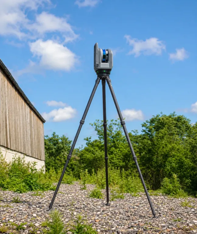
3D Point Cloud Capture Using the Trimble X9 Laser Scanner and T10+ Tablet
Pinpoint Mapping uses a survey-grade Trimble X9 terrestrial laser scanner with a Trimble T10+ tablet and Trimble software to capture, review, register and export detailed spatial information from buildings, sites and structures.
A series of coordinated scan positions records the visible surfaces within the agreed survey area. The 3D point cloud data is reviewed and registered before being exported in the format agreed with the receiving survey, CAD, engineering or BIM team.
The available exports include TDX, TZF, gridded E57 files, a single non-gridded E57 file, PTX, LAS 1.2, LAS 1.4, POD and Autodesk RCP.
The scanner records visible surfaces and cannot capture through solid objects. Furniture, machinery, stored materials, vehicles, vegetation and restricted access can obscure surfaces and create gaps in the data. Critical areas should therefore be identified before the site visit.
3D Point Cloud Survey Scope, Registration and Control
A 3D point cloud survey depends on agreeing the required coverage, registration method, survey control and technical workflow before site attendance.
Survey Coverage
The project brief should identify the areas and features that must be captured, including:
- Internal rooms and circulation areas
- External elevations and building facades
- Accessible roof spaces and roof structures
- Structural frames and exposed construction
- Surrounding land and external site features
- Plant rooms, industrial areas and equipment
- Connections between internal and external data
- Features requiring increased or overlapping coverage
Registration and Survey Control
The appropriate control arrangement depends on the project requirements and intended use of the data.
- Registration between individual scanner positions
- Local project grid where appropriate
- Client-supplied survey control
- Connection to agreed control points
- Internal and external datasets registered together
- Project coordinates where specified and achievable
- Agreed targets or reference marks
- Defined registration and delivery requirements
How Our Point Cloud Survey Process Works
Our point cloud survey process starts by agreeing the required scope and output so that site capture, registration and export are planned around the final use of the 3D point cloud data.
01
Review Requirements
We review the site, required coverage, access arrangements, intended use, file format and survey-control requirements.
02
Capture the Site
The agreed buildings, structures or site areas are captured from a series of coordinated Trimble X9 scan positions.
03
Register and Check
The individual scans are registered together and reviewed against the agreed project requirements.
04
Export and Deliver
The registered data is exported in the agreed file format and supplied through an appropriate digital transfer method.
Point Cloud Data, CAD Drawings or BIM Models?
Point cloud data, measured CAD drawings and BIM models are different deliverables. The correct option depends on your technical capability and the information required by the project.
3D Point Cloud Data
A registered dataset containing the visible measured surfaces captured during the laser scanning survey.
Choose this where your team has the software and experience to inspect the scan data or produce its own project outputs.
Measured CAD Drawings
Two-dimensional drawings interpreted from the point cloud, including floor plans, elevations, sections and roof plans.
See our measured building survey service where finished DWG and PDF drawings are required.
Revit and BIM Models
A structured three-dimensional model produced by interpreting and modelling the required elements from the point cloud.
For scan-to-model workflows, see our Scan to BIM service.
What We Need to Provide a Quotation
Clear project information allows us to assess the site time, survey coverage, registration workflow, control requirements and final 3D point cloud data delivery.
Site and Project Information
- Site address and postcode
- Buildings, rooms or site areas to be captured
- Internal, external or combined coverage
- Existing plans or marked-up drawings
- Site photographs where available
- Access arrangements and working restrictions
- Required site and delivery dates
- Relevant health and safety requirements
Technical Requirements
- Receiving software and software version
- Required TDX, TZF, E57 gridded, E57 single non-gridded, PTX, LAS 1.2, LAS 1.4, POD or Autodesk RCP output
- Required coordinate system or local grid
- Available client-supplied survey control
- Colourised or non-colourised data
- Critical features or restricted areas
- Required scan coverage or density
- Whether finished drawings or models are also required
3D Point Cloud Data Across Bristol, Bath and the South West
Pinpoint Mapping supplies 3D point cloud data and subcontract laser scanning across Bristol, Bath and the wider South West.
Our regular coverage includes Gloucestershire, Somerset, Wiltshire, South Wales and surrounding areas. Projects farther afield can also be considered where the survey scope and programme justify the required travel.
We support point cloud projects involving commercial buildings, residential properties, heritage sites, industrial premises, schools, estates, external land and complex structures.
See the full survey locations we cover or send us the project location for confirmation.
Typical Coverage
- Bristol
- Bath
- Gloucestershire
- Somerset
- Wiltshire
- South Wales
- Wider South West
3D Point Cloud Data FAQs
Answers to common questions about 3D point cloud data, laser scanning, CAD workflows, BIM models, file formats and quotation requirements.
What is 3D point cloud data?
3D point cloud data is a measured digital dataset made up of millions of points captured from a building, site or structure. It represents the visible surfaces recorded during the laser scanning survey and can be used for measurement, CAD drawing production, BIM modelling and project review.
What is the difference between 3D laser scanning and point cloud data?
3D laser scanning is the method used to capture measured information from the site. The point cloud is the digital dataset created by processing and registering the individual scan positions.
Can you supply point cloud data without producing CAD drawings?
Yes. We can provide site scanning, registration and delivery of the agreed point cloud data without producing finished plans, elevations, sections or models. This is particularly useful for survey companies and technical teams with their own processing capability.
How much does 3D point cloud data cost?
The cost of 3D point cloud data depends on the size and complexity of the building or site, required coverage, access conditions, scan density, registration workflow, survey control, file formats and delivery requirements. A site address, marked-up survey extent, photographs and receiving software details help us prepare an accurate quotation.
How long does a 3D point cloud survey take?
The time required depends on the size of the site or building, the number of scan positions, access arrangements, registration requirements, file formats and whether any drawings or models are also required. Smaller point cloud surveys may be captured during one site visit, while larger or more complex projects can require additional processing time.
Which point cloud file formats can you supply?
Available exports include TDX, TZF, E57 gridded files, an E57 single non-gridded file, PTX, LAS 1.2, LAS 1.4, POD and Autodesk RCP. The required format, receiving software and intended use should be confirmed before processing begins.
What is the difference between gridded and non-gridded E57 data?
Gridded E57 files can retain the structure of the individual scan positions. A single non-gridded E57 file combines the registered point cloud into one dataset. The better option depends on the receiving software and intended workflow.
Can internal and external scan data be combined?
Yes. Internal rooms, external elevations and surrounding site areas can be registered into one coordinated project where the required connections, access and survey coverage are included within the agreed brief.
Can the point cloud be connected to survey control?
Yes, where this is specified and included within the quotation. Data can be related to a local grid, client-supplied control or another agreed coordinate arrangement appropriate to the project.
How accurate is a 3D point cloud survey?
The achievable accuracy depends on the survey specification, scanning distances, site conditions, registration method, survey control and intended use. We agree the required scope and workflow rather than applying one general accuracy figure to every project.
Can laser scanning capture hidden surfaces?
No. Laser scanners record visible surfaces and cannot capture through solid objects. Furniture, machinery, stored materials, vegetation, vehicles and inaccessible areas may obscure parts of the building or site.
How are large point cloud files delivered?
Point cloud projects can contain large quantities of data. Completed files are normally supplied through an appropriate digital file-transfer method agreed for the project.
What information should I send for a quotation?
Please send the site address, required survey areas, internal or external coverage, intended use, receiving software, preferred file format, survey-control requirements, access information and required timescale. Existing plans, photographs and marked-up drawings are particularly helpful.
Discuss Your 3D Point Cloud Data Requirements
Send us the site location, required survey coverage, receiving software and preferred point cloud format. We will review the information and confirm the proposed site work, registration approach, deliverables and timescale.
A marked-up survey extent, existing drawings, project specifications, site photographs and access information can also help us understand the work and prepare an accurate quotation.