
Mobile Mapping Services for Highways, Infrastructure and Large Sites
Pinpoint Mapping provides Mobile Mapping Services for highways, motorways, transport corridors, infrastructure projects and larger sites across Bristol, Bath and the South West.
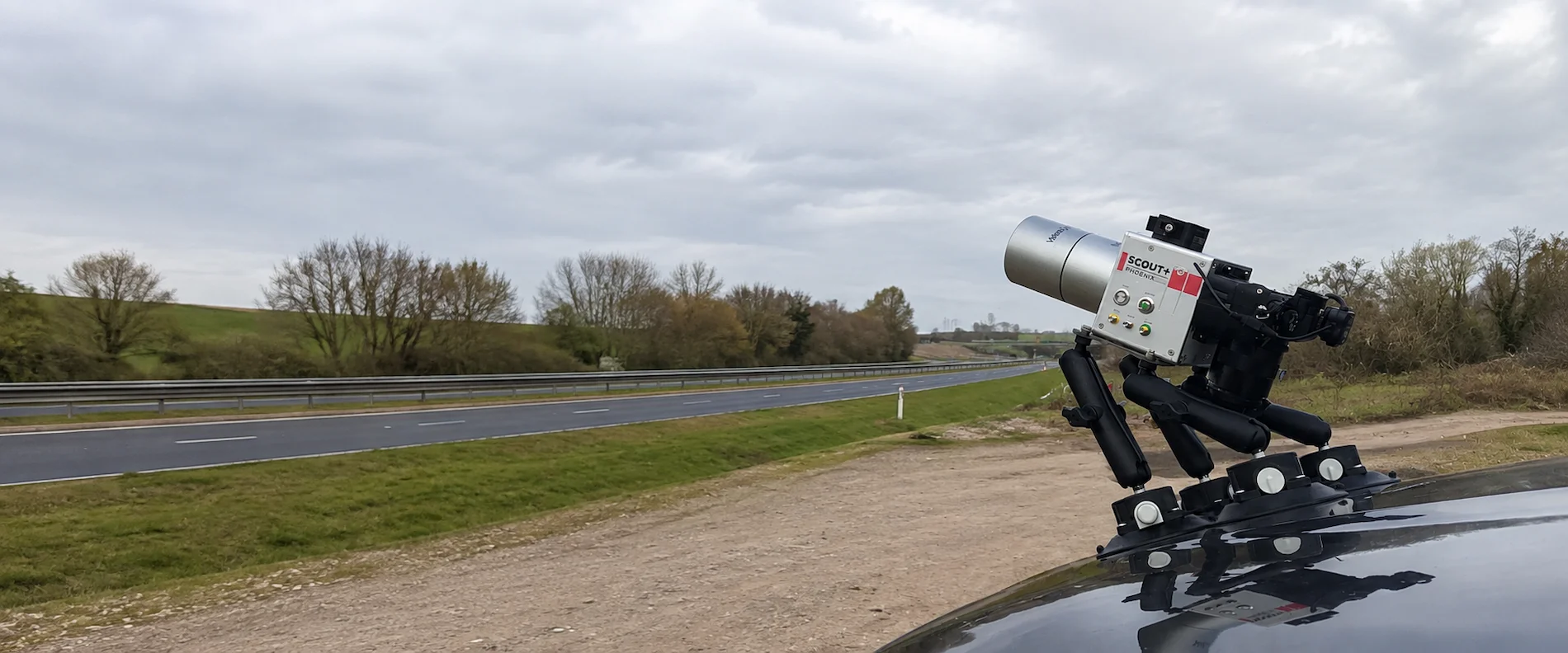
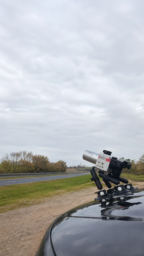
Vehicle-mounted LiDAR captures large quantities of three-dimensional information as the survey vehicle travels through the required route. The resulting data can be processed into coordinated point clouds, CAD drawings, levels, sections and topographical information.
Mobile Mapping Surveys are particularly effective where a project extends over a substantial distance and repeated conventional survey setups would be inefficient.
Mobile LiDAR Surveys can also provide a detailed existing-condition record that allows visible highway and infrastructure features to be reviewed during subsequent design and engineering work.
The survey method is selected around the site, required accuracy and intended deliverables. Mobile capture can therefore be combined with total station surveying, aerial LiDAR or other measurement techniques where different parts of the project require different approaches.
For conventional land measurement, see our topographical surveys. Projects focused on roads and transport infrastructure can also be supported through our Highway Surveys service.
Mobile Mapping Surveys at a Glance
Our mobile survey capability includes:
Mobile Laser Scanning
Continuous three-dimensional LiDAR capture from a moving survey platform.
Highway Mobile Mapping
Efficient capture of motorways, dual carriageways, road corridors and visible highway infrastructure.
Mobile LiDAR Surveys
Mobile LiDAR Surveys produce high-density georeferenced point cloud data for long routes and suitable accessible sites.
Mobile Mapping Services
Mobile Mapping Services provide coordinated three-dimensional datasets for CAD production, design and engineering workflows.
Where Mobile Mapping Surveys Are Most Effective
Mobile Mapping Surveys are most effective where measured information is required over long routes or extensive sites with suitable vehicle access and visibility.
The survey specification is agreed around the route, features required, accuracy, project stage and intended outputs.
Motorways & Major Roads
Highway Mobile Mapping can record long sections of motorway, dual carriageway and major road together with visible carriageway and roadside features.
Infrastructure Corridors
Mobile Mapping Surveys can support transport and infrastructure projects where existing-condition information is required continuously over a substantial distance.
Large Sites & Estates
Industrial estates, logistics sites, campuses and private road networks may benefit where vehicle access makes continuous LiDAR capture practical.
Junction Improvements
Existing carriageway geometry, kerbs, signs, barriers and surrounding highway features can support junction alteration and improvement schemes.
Road Widening
Mobile Mapping Services can provide measured information across existing road corridors where widening or alignment changes are being considered.
Development Beside Highways
Vehicle-based capture can be coordinated with conventional land surveying where development sites extend beyond the road corridor.
Highway Mobile Mapping for Roads and Transport Infrastructure
Highway Mobile Mapping is particularly useful where substantial lengths of road need to be surveyed efficiently.
Motorways and high-speed dual carriageways present different conditions from conventional development sites. Traffic speeds, access restrictions and route length can make repeated static survey positions less practical.
Mobile Mapping Surveys allow visible highway information to be captured continuously as the survey vehicle travels along the route.
The point cloud can support highway improvements, junction alterations, road widening, access design and existing-condition surveys.
Mobile LiDAR Surveys use a vehicle-mounted LiDAR survey system to record carriageway edges, road markings, central reservations, safety barriers, signs, gantries, lighting columns, footways, verges and other visible infrastructure.
Mobile Laser Scanning also creates a three-dimensional record that can be reviewed during processing, helping the project team understand the relationship between highway features and surrounding terrain.
For projects requiring detailed road geometry and transport survey information, see our dedicated Highway Surveys service.
Typical Highway Features
- Carriageway and kerb edges
- Road and lane markings
- Hard shoulders
- Central reservations
- Safety barriers
- Signs and gantries
- Lighting columns
- Street furniture
- Footways and cycleways
- Verges and embankments
- Drainage features
- Visible structures
Projects affecting England’s strategic road network may also need to consider information and requirements published by National Highways.
Mobile Laser Scanning and Mobile LiDAR Surveys
Mobile Mapping Surveys do not have to rely on one survey technique throughout a project.
Different technologies can be combined according to route length, access, visibility, terrain, accuracy requirements and final deliverables.
Mobile LiDAR Surveys
Mobile LiDAR Surveys collect high-density three-dimensional measurements continuously from a vehicle-mounted survey system travelling along the route.
The method is particularly useful for motorways, major roads and long accessible infrastructure corridors.
Total Station Surveying
Total station surveying remains appropriate for adjoining fields, boundaries, drainage, ground levels and areas away from the vehicle route.
Conventional observations can be coordinated with the mobile dataset using common survey control.
Mobile Mapping Services
Mobile Mapping Services create coordinated point cloud information for 3D mobile mapping surveys, CAD production and wider existing-condition survey requirements.
Additional survey techniques can be incorporated where the site extends beyond the area suitable for vehicle capture.
Mobile Laser Scanning is therefore one part of a wider survey methodology rather than a replacement for every conventional measurement technique.
Combining Mobile Mapping Surveys with Other Survey Technologies
Large projects often contain areas that are better suited to different survey techniques. The resulting datasets can be related to common survey control and combined into one coordinated project survey.
Vehicle LiDAR + Total Station Surveying
A development site beside a motorway is a typical example.
Mobile Mapping Surveys can record the motorway, road markings, barriers, signs and associated highway features using vehicle-mounted LiDAR.
The adjoining fields, boundaries, drainage and ground levels can then be surveyed using a total station.
The datasets can be coordinated within the same project coordinate system and combined into one CAD drawing.
Our topographical survey service can provide detailed land information alongside the mobile survey data.
Vehicle LiDAR + Aerial LiDAR
Large infrastructure projects can extend from a motorway corridor across substantial areas of agricultural or open land.
Mobile Mapping Surveys can capture the highway using vehicle-mounted LiDAR while aerial LiDAR covers adjoining agricultural land where appropriate.
Both datasets can be related to common survey control and brought into the same coordinate system.
The information can then form one continuous topographical survey drawing covering the highway corridor and wider land area.
Conventional measurements can also be added where individual features require direct observation.
Need Mobile Mapping Surveys for Your Project?
Send us the survey extent and project requirements and we can advise whether vehicle-mounted LiDAR, conventional surveying or a combined approach is most appropriate.
Request a Survey QuotationMobile Mapping Surveys - Point Clouds & Survey Deliverables
Mobile Mapping Surveys can produce detailed three-dimensional information that is processed into practical outputs for design, engineering, planning and construction teams.
The required deliverables are agreed before capture so the survey and processing are focused on information relevant to the project.
Point Cloud Data
Registered and coordinated three-dimensional information can represent visible surfaces and features throughout the surveyed route.
CAD Survey Drawings
Required features can be extracted from the point cloud and developed into coordinated DWG drawings for planning and engineering work.
Levels & Sections
Spot levels, breaklines, cross sections and longitudinal sections can be produced where required by the project specification.
Where imagery forms part of the capture, colourised point cloud information can assist with identifying visible highway features and structures.
Mobile Mapping Services can also be combined with conventional topographical information to create a consistent measured base across the wider project.
Survey Control & Georeferencing
Reliable Mobile Mapping Surveys depend on correctly positioning and checking the captured data within the coordinate system required by the project.
Survey control can be established to suit the accuracy requirements of the scheme and the need to integrate other measured datasets.
Depending on the project, this may include existing control stations, verification observations and connection to an agreed national or local coordinate system.
Mobile LiDAR Surveys may also be supplemented by conventional observations where additional checking or direct measurement is required.
Benefits of Mobile Laser Scanning
- Efficient capture across long routes
- Dense three-dimensional measured information
- Reduced repeated carriageway setups
- Existing-condition point cloud record
- Flexible CAD and survey outputs
- Integration with other survey methods
Limitations & Utility Information
Mobile Mapping Surveys record visible surfaces. Vegetation, walls, parked vehicles and other obstructions can conceal required features.
Fields, inaccessible land and features well away from the vehicle route may therefore require conventional surveying or aerial capture.
Mobile Laser Scanning also does not establish the complete position or depth of buried utilities simply because service covers appear within the point cloud.
Visible utility-related information may include inspection covers, drainage features, cabinets, lighting columns and other above-ground infrastructure.
Where underground service information is required, specialist detection should be specified through our Utility Surveys service.
Mobile Mapping Surveys Bristol, Bath & the South West
Pinpoint Mapping provides Mobile Mapping Surveys and Mobile Mapping Services for suitable projects throughout Bristol, Bath and the wider South West.
Our regular coverage includes South Gloucestershire, Gloucestershire, Somerset, Wiltshire, the Cotswolds and South Wales.
Highway Mobile Mapping may suit a motorway corridor, while adjoining development land can be surveyed conventionally and larger areas of agricultural land may suit aerial LiDAR.
The methodology is selected around the site, required accuracy, access, visibility and final outputs rather than applying one technology to every project.
Larger highway and infrastructure schemes farther afield can also be considered where mobile capture provides a practical advantage.
A marked-up survey extent is normally the best starting point when requesting a quotation for Mobile Mapping Surveys.
Why Choose Pinpoint Mapping?
- Survey method selected around the project
- Specialist vehicle-mounted LiDAR technology available where appropriate
- Mobile and conventional survey integration
- Aerial LiDAR integration where appropriate
- Practical CAD and topographical outputs
- Survey control matched to the project brief
- Coverage throughout the South West
For a Quotation
Send us the survey extent, route length where known, required features, accuracy requirements and intended CAD or point cloud deliverables.
Mobile Mapping Surveys FAQs
Answers to common questions about Mobile Mapping Surveys, Mobile Mapping Services, Mobile Laser Scanning, Mobile LiDAR Surveys and Highway Mobile Mapping.
What are Mobile Mapping Surveys?
Mobile Mapping Surveys use survey equipment mounted to a moving platform to capture three-dimensional information along a road, infrastructure corridor or suitable accessible site.
The captured LiDAR information can be processed into point clouds, CAD drawings, levels, sections and other agreed survey outputs.
Can Mobile Mapping Surveys be used on motorways?
Yes. Mobile Mapping Surveys are particularly useful for motorways, dual carriageways and long highway corridors.
Highway Mobile Mapping allows visible road and infrastructure information to be captured continuously while travelling along the route.
What is Mobile Laser Scanning?
Mobile Laser Scanning uses a laser scanner carried on a moving survey platform to collect three-dimensional measurements continuously.
The resulting measurements form a point cloud representing visible surfaces and features around the survey route.
What are Mobile LiDAR Surveys?
Mobile LiDAR Surveys use LiDAR equipment mounted to a survey vehicle to capture visible highway, infrastructure and surrounding site information.
It is particularly useful where substantial route lengths would otherwise require numerous conventional survey setups.
What are Mobile Mapping Services?
Mobile Mapping Services create a coordinated three-dimensional dataset of visible features along the surveyed route or site.
The information can support point cloud delivery, CAD drawing production, levels, sections and wider existing-condition survey requirements.
Can mobile LiDAR be combined with a total station survey?
Yes. A motorway can be captured using vehicle-mounted LiDAR while adjoining fields, boundaries and development land are surveyed using a total station.
Both datasets can then be coordinated within the same project survey.
Can vehicle LiDAR be combined with aerial LiDAR?
Yes. Vehicle-mounted LiDAR can capture the road corridor while aerial LiDAR covers larger areas of adjoining agricultural or open land where appropriate.
The separate datasets can be related to common survey control and combined into one coordinated topographical drawing.
Does mobile mapping show underground utilities?
No. Mobile Mapping Surveys record visible surface information and do not establish the complete route or depth of buried services.
A separate utility survey should be specified where underground service information is required.
Where are Mobile Mapping Surveys available?
Mobile Mapping Surveys are available for suitable projects throughout Bristol, Bath, Gloucestershire, Somerset, Wiltshire, South Wales and the wider South West.
Larger highway and infrastructure projects farther afield can also be considered.
Discuss Your Mobile Mapping Surveys Requirements
Send us the proposed route, survey extent, intended use and required deliverables.
We will review the information and advise whether Mobile Mapping Surveys, conventional surveying or a combination of methods provides the most appropriate approach.
A marked-up survey extent, existing plans, project specifications and accuracy requirements can help us prepare an appropriate quotation.