
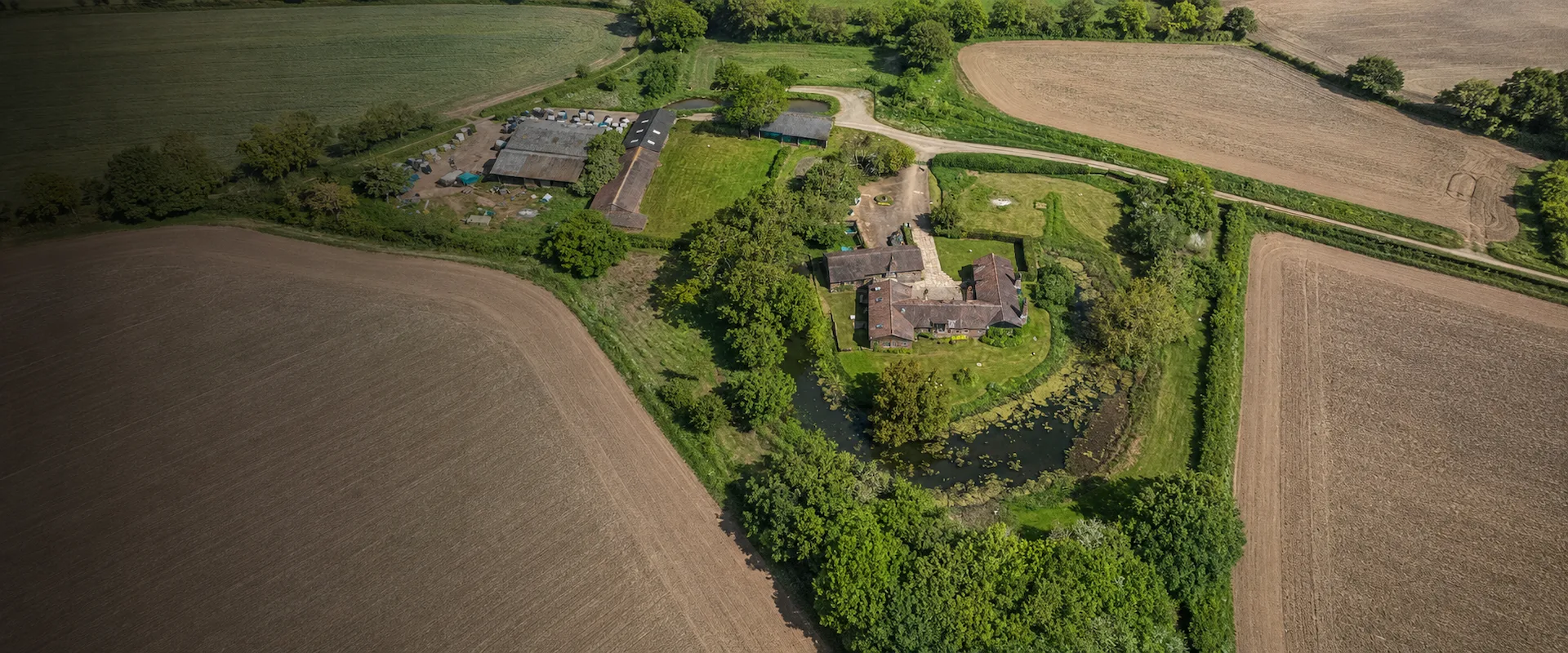
Accurate Mapping for Farms, Estates and Rural Land
Pinpoint Mapping provides farm and estate surveys in Bristol, Bath and across the South West for landowners, estate managers, rural property professionals, planning consultants and project teams.
Our farm and estate surveys create a coordinated measured record of land, field boundaries, buildings, levels, access routes, drainage features and other visible assets required for estate management, planning, rural development and land improvement projects.
Each survey is scoped around the size and character of the site, required level of detail, coordinate system and final deliverables. This provides a practical mapping base for managing existing land and supporting future project decisions.
Where a project requires additional detail, farm and estate surveys can be combined with a topographical survey, measured building survey, 3D laser scanning or registered 3D point cloud data. For suitable sites, aerial drone surveys can also support wider visual coverage.
What Farm and Estate Surveys Record
The precise survey content is agreed for each project. Farm and estate surveys can record the visible land, physical features, levels and assets needed for estate management, planning and rural development.
Land, Boundaries and Access
- Field boundaries and land parcels
- Walls, fences and hedgerows
- Gates and access points
- Farm tracks and estate roads
- Yards and hardstanding
- Measured field and land areas
Levels and Natural Features
- Spot levels and changes in level
- Slopes, banks and terrain
- Trees and woodland
- Ditches and drainage features
- Ponds and watercourses
- Significant vegetation
Buildings and Estate Assets
- Farm buildings and structures
- Barns and agricultural buildings
- Visible service features
- Poles, pylons and infrastructure
- Walls and retaining structures
- Other agreed estate assets
Farm Mapping Services for Rural Land and Estates
Our farm mapping services create an accurate geographical record of rural land, buildings, boundaries, access routes and other physical features. The finished mapping provides landowners, estate managers, consultants and contractors with coordinated information for practical management and project use.
Depending on the agreed brief, farm mapping and estate mapping can include:
- Fields, land parcels and measured areas
- Boundaries, gates and access routes
- Farm buildings and estate structures
- Tracks, yards and hardstanding
- Site levels and terrain information
- Woodland, trees and vegetation
- Ditches, ponds and watercourses
Farm and estate survey deliverables can include DWG drawings, PDF plans, three-dimensional survey information and GIS-ready spatial data where required.
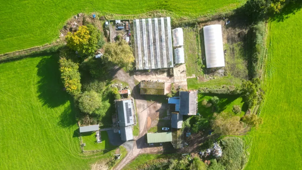
Need Accurate Farm and Estate Surveys for Your Project?
Send us the site location, required survey area and intended use, and we’ll advise on the appropriate survey scope, mapping requirements, deliverables and next steps.
Request a Survey QuotationWhen Are Farm and Estate Surveys Needed?
Farm and estate surveys provide accurate measured information for rural land management, planning, development, building projects, access improvements and estate diversification. A rural land survey can also provide the measured base needed for projects involving larger agricultural or estate landholdings.
Estate and Land Management
A coordinated survey provides a clear measured record of the landholding and its principal physical features.
- Topographical surveys for levels, terrain and detailed site information
- Fields, boundaries, tracks, drainage features and estate assets
- Measured information for planning, design and land management
Planning, Buildings and Access
Rural projects often require detailed information about existing buildings, structures and access arrangements.
- Measured building surveys for floor plans, elevations and sections
- Barns, agricultural buildings, estate cottages and conversions
- Highway surveys for entrances, access roads and highway interfaces
Large Estates and Rural Projects
Larger farms and estates can require coordinated survey information across extensive areas of land and property.
- Aerial drone surveys for wider coverage and current imagery
- Land, buildings, tracks and boundaries across larger holdings
- Clear information for estate managers, consultants and contractors
Survey Methods Selected for the Site and Project
Farm and estate surveys may use one method or a combination of survey technologies depending on the size of the landholding, site conditions, required accuracy, level of detail and intended outputs.
Total Station Surveying
Survey-grade total stations are used to measure coordinated site detail, levels and control points. They are well suited to recording defined boundaries, buildings, tracks, surfaces, structures and changes in level.
GNSS Survey Control
GNSS equipment can establish survey control and relate farm and estate surveys to the Ordnance Survey National Grid and Datum where site conditions and the project brief require it.
3D Laser Scanning
Our survey-grade Trimble X9 3D laser scanner can capture dense measured information around buildings, structures and complex areas. Registered 3D point cloud data can also be supplied where required.
Aerial Drone Surveying and GIS
For suitable sites, aerial imagery or drone surveying can support wider coverage or provide current visual information alongside ground-based measurements, subject to the required accuracy, site conditions and flight restrictions. Surveyed features can also be organised within GIS where structured spatial information is required across a farm or estate.
Survey Scope Agreed in Advance
Before site attendance, we confirm the survey boundary, required land coverage, visible features and levels, coordinate system, datum, output formats, access arrangements and delivery programme.
A marked-up plan showing the required survey extent is usually the clearest way to define the work.
Draw Your Required Survey Area
Visit our survey quotation page on a desktop computer to search for the site address and use the interactive survey map area draw tool. Marking the required survey boundary helps us understand the location, approximate area and scale of the proposed work.
Why Choose Pinpoint Mapping for Farm and Estate Surveys?
Pinpoint Mapping is an owner-led measured survey practice based near Bristol. Our farm and estate surveys provide clear project scope, direct communication and practical mapping and digital deliverables for rural land and estate projects.
Contact us to discuss your site.
Clear Project Scope
The survey extent, required features, coordinate system, level of detail and final deliverables are agreed before site work begins, helping avoid assumptions and gaps in the survey brief.
Practical Survey Deliverables
Survey drawings, mapping and digital information are prepared for practical use in estate management, planning, rural development and project coordination.
Appropriate Survey Technology
Total station, GNSS, 3D laser scanning, aerial surveying and GIS methods are selected to suit the site conditions, required accuracy and intended survey outputs.
Regional Service and Direct Contact
Based near Bristol, we provide farm and estate surveys across Bristol, Bath, Gloucestershire, Somerset, Wiltshire, South Wales and the wider South West.
A Clear Farm and Estate Survey Process
We establish the survey requirements at the start, capture the agreed land and site information and prepare the completed drawings, mapping or digital data for practical use.
STEP 1
Review Requirements
We review the site location, proposed survey area, required detail, available information, intended outputs and project timescale.
STEP 2
Agree the Scope
The survey limits, recorded features, control requirements, access arrangements, quotation and expected programme are confirmed.
STEP 3
Survey and Process
The site is surveyed using suitable equipment. Captured information is then checked, processed and prepared for drawing or mapping production.
STEP 4
Check and Deliver
Completed drawings, mapping and digital data are checked and issued in the agreed formats using the confirmed coordinate system and delivery arrangements.
Farm and Estate Surveys Across Bristol, Bath and the South West
Pinpoint Mapping provides farm and estate surveys across Bristol, Bath and the wider South West for estate management, planning, rural development and land projects.
Our regular coverage includes Gloucestershire, Somerset, Wiltshire, South Wales and surrounding areas. Projects farther afield can also be considered where the survey scope and programme justify the required travel.
See the full survey locations we cover, request a survey quotation or send us the project location for confirmation.
Typical Coverage
- Bristol
- Bath
- Gloucestershire
- Somerset
- Wiltshire
- South Wales
- Wider South West
Farm and Estate Survey FAQs
Answers to common questions about farm and estate surveys, rural mapping, GIS, survey content, cost, timescale and project deliverables.
What are farm and estate surveys?
Farm and estate surveys create a measured record of rural land and the visible physical features required for a project. This can include field boundaries, levels, buildings, tracks, access points, drainage features, woodland, watercourses and other agreed information.
What does a rural estate survey include?
A rural estate survey can include land boundaries, levels, buildings, tracks, access points, drainage features, woodland, watercourses and other agreed estate assets. The survey content is defined around the intended use of the information.
What is farm and estate mapping used for?
Farm and estate mapping can support estate management, planning applications, rural development, diversification projects, access improvements, building projects and communication with consultants and contractors.
How much do farm and estate surveys cost?
The cost of farm and estate surveys depends on the size and complexity of the landholding, required level of detail, access conditions, survey control requirements, deliverable formats and project timescale. A marked-up plan showing the required survey extent is usually the clearest way for us to prepare an accurate quotation.
How long do farm and estate surveys take?
The time required for farm and estate surveys depends on the size of the landholding, survey extent, access arrangements, terrain, required level of detail, survey control, processing requirements and final deliverables. Smaller rural surveys may be completed during one site visit, while larger estates or more detailed mapping projects can require additional site work and processing time.
Can you measure field boundaries and land areas?
Yes. Defined field boundaries and land parcels can be surveyed and their areas calculated where this forms part of the agreed survey scope. The intended use of the measurements should be confirmed before the survey.
Can you provide GIS mapping for farms and estates?
Yes. Surveyed features and suitable existing spatial information can be organised within GIS where a structured geographical dataset is required. The required information, structure and outputs should be agreed before work begins.
Can you survey farm buildings as well as the surrounding land?
Yes. Building footprints and external features can form part of farm and estate surveys. Where more detailed existing-building information is required, we can also provide measured building surveys, elevations, sections and 3D laser scanning.
Can aerial drone imagery be included?
Yes. For suitable sites, aerial drone surveying can provide current imagery or wider visual coverage alongside ground-based measurements. Suitability depends on the required outputs, site conditions, airspace and operational restrictions.
Can farm and estate surveys be related to the Ordnance Survey National Grid?
Yes, where this is required and suitable for the project. Survey information can be related to the Ordnance Survey National Grid and Datum or completed using an agreed local or project grid.
What survey equipment do you use?
We use professional survey equipment including total stations, GNSS and 3D laser scanning equipment where appropriate. Aerial surveying and GIS can also form part of the project where suitable.
How accurate are farm and estate surveys?
The required accuracy depends on the project, site conditions, survey control, feature type and intended use. We agree the survey scope and control requirements before work begins rather than applying one general accuracy figure to every project.
Do you cover Bristol, Bath and the South West?
Yes. Pinpoint Mapping provides farm and estate surveys across Bristol, Bath, Gloucestershire, Somerset, Wiltshire, South Wales and the wider South West.
Discuss Your Farm and Estate Survey Requirements
Send us the site address, required survey area, intended use and preferred deliverables. We will review the information and advise on the appropriate farm and estate survey scope, control and outputs.
A marked-up survey extent, existing plans, project specifications, site photographs and access information can help us understand the work and prepare an accurate quotation.