
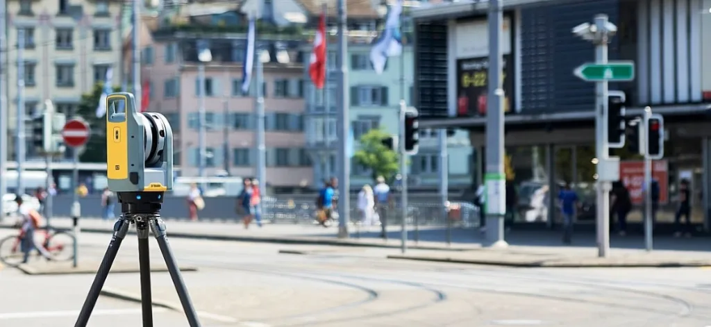
How does 3D laser scanning work? A terrestrial laser scanner captures millions of measured points across the visible surfaces of a building, structure or site. Together, these measurements create a detailed three-dimensional point cloud representing the shape, position and spatial relationship of the surveyed environment.
During a 3D laser scanning survey, the scanner is moved through or around the survey area so that the required surfaces are captured from multiple overlapping positions. The individual scans are then registered together, checked against survey control and processed into the point-cloud files, CAD drawings or models required by the project team.
This guide explains the complete laser scanning survey workflow, from initial planning and site capture through to registration, point-cloud processing, CAD survey drawings and three-dimensional models.
For information about commissioning a survey, visit our 3D laser scanning surveys service page.
What Is 3D Laser Scanning?
3D laser scanning is a surveying method used to record the dimensions and visible geometry of an existing environment.
The scanner sends laser pulses towards surrounding surfaces and measures the distance between the instrument and the point where each pulse is reflected.
By measuring horizontal and vertical angles alongside each distance, the instrument calculates the three-dimensional position of each recorded point.
A single scan may capture a very large number of measured points. Together, these form a point cloud showing the visible surfaces surrounding the scanner.
The point cloud may include:
- Walls and floors
- Ceilings and roofs
- Doors and windows
- Columns and beams
- Stairs and changes in level
- Building services
- Plant and machinery
- External elevations
- Structures and terrain
The scanner records geometry rather than automatically identifying every object. Surveyors and CAD technicians interpret the captured data when preparing the required drawings and models.
How Does 3D Laser Scanning Work on Site?
How does 3D laser scanning work on site? The exact workflow depends on the size and complexity of the building or site, the required outputs, survey-control requirements and the accuracy specification.
A typical 3D laser scanning survey involves the following stages.
1. Reviewing the Survey Brief
Before the site visit, the surveyor establishes what information the client requires and how the finished survey will be used.
The brief may confirm:
- The buildings or areas to be surveyed
- Whether internal and external areas are required
- The floors, roofs, elevations and structures to include
- The required drawing scale
- The required level of detail
- The coordinate system and level datum
- The required point-cloud format
- The required CAD or BIM outputs
- Site access and security arrangements
- The required delivery programme
A clear brief is important because scanning an entire building is not automatically the same as producing every possible drawing from the captured data.
2. Planning Scanner Positions
A terrestrial laser scanner works using line of sight. It can only measure surfaces that are visible from its current position.
The surveyor therefore plans a series of overlapping scanner locations throughout the building or site.
Scanner positions may be required:
- Inside individual rooms
- Along corridors
- At staircases and landings
- At building entrances
- Around external elevations
- Within roof spaces
- Inside plant rooms
- Around columns, machinery and other obstructions
Additional positions are often required around complex geometry or where walls, furniture, vegetation or structures obscure the scanner’s line of sight.
3. Establishing Survey Control
Survey control provides a coordinated framework for the scanning work.
Control points may be established using a total station, GNSS equipment or another appropriate surveying method.
These points can be used to:
- Relate the scans to a site coordinate system
- Connect internal and external survey data
- Maintain consistency between different floors or buildings
- Check the registered point cloud
- Relate the survey to an agreed level datum
- Support future survey or setting-out work
Not every project needs to be connected to national coordinates, but the required coordinate system and datum should be agreed before the survey begins.
4. Capturing Each Scan
At each position, the instrument rotates and measures the surrounding visible surfaces.
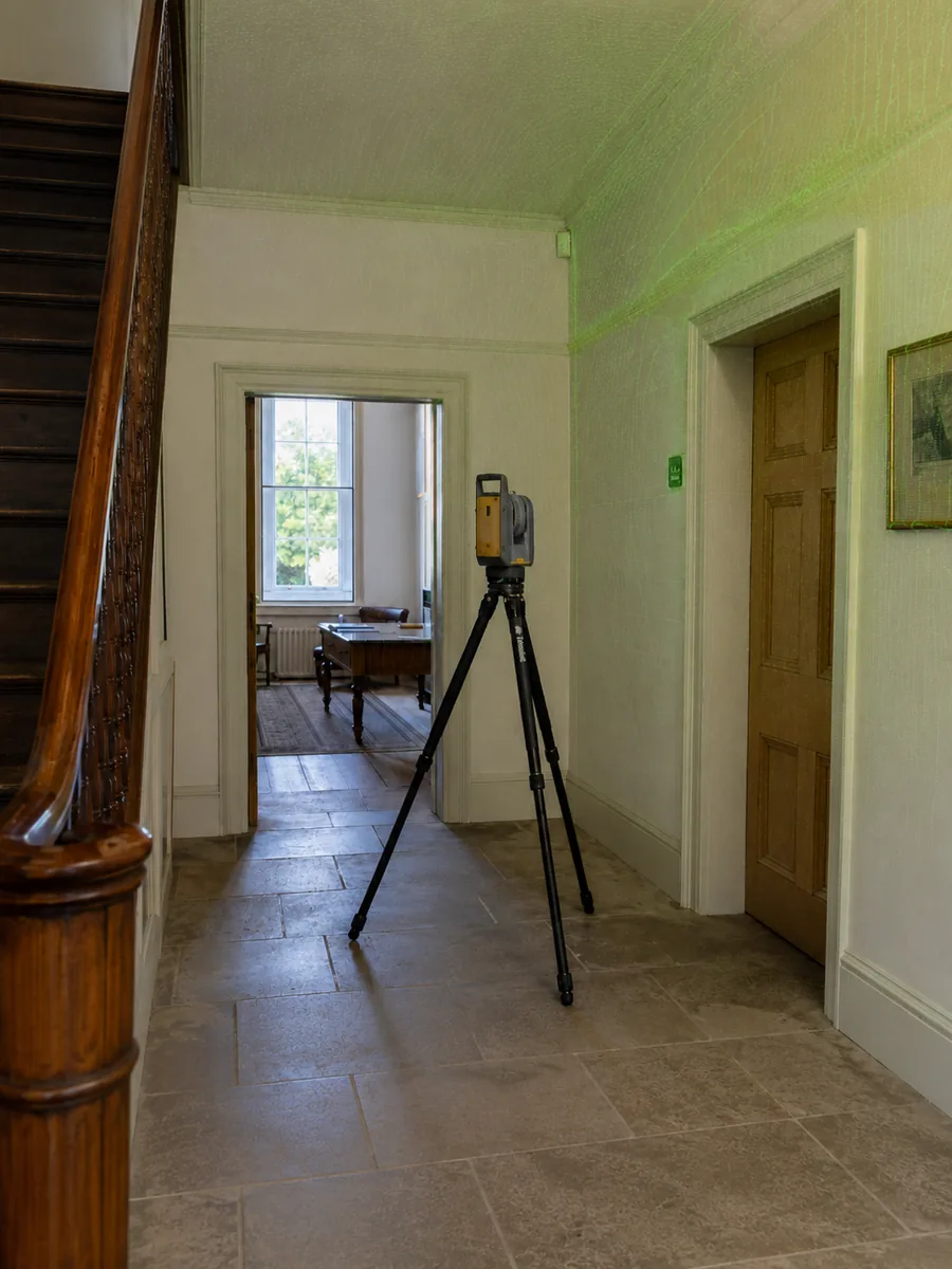
The scanner records distances and angles to produce a three-dimensional set of measured points. Modern survey scanners can also capture photographic imagery so that colour information can be applied to the point cloud.
The scanning density and quality settings may be adjusted according to:
- The distance to the surfaces
- The required level of detail
- The complexity of the area
- The amount of movement on site
- The time available
- The intended output
A higher-density scan may capture finer detail but can take longer and generate a larger dataset.
5. Moving Through the Site
Once a scan has been completed, the instrument is moved to the next planned position.
Successive scans need sufficient overlap so that they can be connected during registration.
The surveyor continues through the building or site until the required areas have been captured. Field software may allow scans to be reviewed and registered while the survey is still in progress.
This helps identify missing coverage before leaving the site.
6. Recording Supporting Observations
Laser scanning captures extensive geometric information, but additional observations may still be required.
The surveyor may also record:
- Room names and uses
- Construction materials
- Door and window descriptions
- Floor-level information
- Survey-control measurements
- Drainage or service details
- Features hidden from the scanner
- Photographs and site notes
These observations provide context that cannot always be derived reliably from the point cloud alone.
What Is a 3D Point Cloud?
A point cloud is a collection of three-dimensional measured points.
Each point has a position defined by X, Y and Z coordinates. Depending on the equipment and processing method, the points may also contain colour or intensity information.
When viewed together, the points form a detailed representation of the scanned environment.
A point cloud is not the same as a finished CAD drawing or BIM model. It is the measured source dataset from which further outputs can be produced.
For more information about point-cloud deliverables and formats, see our 3D point cloud data service.
How Are Multiple Laser Scans Joined Together?
The process of connecting individual scans into one coordinated dataset is known as registration.
Each scanner position initially has its own local coordinate system. Registration calculates how those individual scans relate to one another.
Cloud-to-Cloud Registration
Cloud-to-cloud registration compares overlapping surfaces within adjacent scans.
The processing software identifies matching geometry and calculates the best alignment between the datasets.
This method can be efficient where the scans contain sufficient overlap and varied geometry.
Target-Based Registration
Artificial targets may be positioned around the site and captured from more than one scanner location.
By identifying the same targets in multiple scans, the software can calculate the relationship between them.
Survey-Control Registration
Scans may also be connected or checked using coordinated survey-control points.
This can be particularly important where:
- The building is large or complex
- Internal and external datasets must be linked
- Several survey teams or instruments are involved
- The point cloud must relate to an existing site grid
- The project requires independent checks
Registration Checks
Registration software may report how closely overlapping scans agree, but a low registration error does not by itself prove that the complete survey is accurate.
The registered point cloud should also be reviewed against project control, known dimensions and independent check measurements where appropriate.
How Is a Laser Scan Point Cloud Processed?
After registration, the point cloud is reviewed and prepared for its intended use.
Processing may include:
- Removing unwanted points
- Checking registration
- Applying coordinates and levels
- Combining internal and external scans
- Dividing the data by floor, building or area
- Creating clipping regions
- Applying photographic colour
- Exporting agreed file formats
- Preparing data for CAD or BIM software
The amount of processing required depends on the project and the software being used by the client or project team.
How Are CAD Survey Drawings Produced from Laser Scan Data?
Once the registered point cloud has been checked, it can be used as measured source information for CAD survey drawings.
The technician views appropriate sections or slices through the point cloud and interprets the measured geometry required for the agreed drawing specification.
For a broader explanation of drawing formats and measured survey outputs, read our guide to CAD survey drawings.
Floor Plans
A horizontal slice through the point cloud can be used to draw walls, doors, windows, stairs, columns and other plan features.
Further interpretation is normally required where features are hidden, obscured or positioned above or below the selected cutting plane.
External Elevations
The point cloud can be viewed orthographically from each side of the building.
The technician may then draw:
- External walls
- Doors and windows
- Roof lines
- Ridges and eaves
- Rainwater goods
- Architectural features
- Visible materials
- Changes in level
Internal Elevations
Internal elevations may be produced where the project requires detailed information about walls, openings, fitted features or architectural details.
Building Sections
Vertical slices through the registered point cloud can be used to prepare building sections.
Sections may show:
- Floor levels
- Ceiling levels
- Roof structure
- Staircases
- Changes in level
- Structural elements
- The relationship between floors
Roof Plans
External scanning can help record roof geometry, including ridges, hips, valleys, parapets, rooflights and changes in roof level.
Some roof areas may remain hidden from ground-based scanner positions and may require elevated access, aerial data or additional observations.
More information about plans, elevations and sections is available on our measured building surveys page.
What Outputs Can a 3D Laser Scanning Survey Produce?
The registered point cloud can support several survey, design and modelling outputs in addition to traditional two-dimensional drawings.
Registered Point-Cloud Files
The registered point cloud may be supplied in agreed industry formats for use in point-cloud viewing, CAD, engineering or modelling software.
The required format should be confirmed before processing because software compatibility varies.
Three-Dimensional CAD Models
Selected structures, surfaces or building elements can be modelled in three dimensions using the point cloud as measured reference data.
Building Information Models
A BIM model may be created from the point cloud where the project requires intelligent modelled building elements.
The required level of information and modelling tolerance should be agreed clearly before work begins.
A point cloud does not automatically become a BIM model. Producing the model involves interpretation, modelling decisions and additional office work.
For projects requiring Revit or BIM deliverables, see our Scan to BIM services.
Mesh and Surface Models
Point-cloud data may be processed into surface meshes for selected visualisation, analysis or engineering applications.
Deviation and Comparison Analysis
Point clouds can be compared with design models or previous surveys to identify differences between existing, proposed or changing conditions.
Where Are 3D Laser Scanning Surveys Used?
3D laser scanning surveys are used where detailed, coordinated information about existing buildings, structures or sites is required.
Measured Building Surveys
Laser scanning is widely used to record existing buildings for refurbishment, alteration, planning and design work.
It is particularly useful where a building has irregular geometry, multiple levels or complex architectural features.
Historic and Listed Buildings
Point clouds can provide a detailed measured record of historic structures and architectural features.
Historic England publishes specialist guidance on 3D laser scanning for heritage, including its use in architecture and archaeology.
Industrial and Plant Environments
Laser scanning can capture machinery, pipework, steelwork and complex industrial installations.
The data may support modification, coordination, clearance checking and as-built recording.
Construction and As-Built Surveys
Scanning can provide a dated record of completed work and allow existing conditions to be compared with design information.
Structural and Engineering Surveys
Engineers may use point-cloud data to understand the geometry of bridges, retaining walls, structural frames and other assets.
Complex or Inaccessible Areas
Laser scanning can reduce the amount of direct physical measurement required in awkward or difficult-to-access areas.
It does not remove the need for safe access planning, and hidden surfaces still cannot be recorded without adequate line of sight.
What Are the Benefits of 3D Laser Scanning?
Dense Survey Information
The scanner records a dense set of measurements across visible surfaces rather than a limited selection of individually observed points.
Efficient Site Capture
Large quantities of spatial information can be recorded during the site visit, reducing the need to measure every feature individually.
Detailed Three-Dimensional Record
The point cloud preserves the spatial relationship between recorded features and provides a useful reference after the site work has been completed.
Support for Multiple Outputs
The same registered dataset may support floor plans, elevations, sections, models and other agreed outputs.
Reduced Return Visits
A comprehensive point cloud can allow additional dimensions and views to be examined later, provided the required surfaces were captured clearly during the original survey.
What Are the Limitations of 3D Laser Scanning?
Line of Sight
The scanner cannot measure through solid objects.
Areas hidden behind furniture, machinery, vegetation, parked vehicles, walls or other obstructions will not be captured from that scanner position.
Reflective and Transparent Surfaces
Glass, mirrors, highly reflective finishes and some dark or wet surfaces can produce incomplete, distorted or noisy measurements.
Movement
People, vehicles, machinery and vegetation moving during a scan may create unwanted or duplicated points.
Large Data Volumes
Point-cloud files can be large and may require appropriate hardware, storage and specialist software.
Interpretation Is Still Required
A scanner records measured points but does not automatically understand what each point represents.
Surveyors and technicians must still interpret the data and apply the required drawing conventions.
It Does Not Replace Every Survey Method
Total stations, GNSS equipment, direct measurements and other survey methods may still be required for:
- Survey control
- Independent checks
- Hidden features
- Feature identification
- Drainage information
- Boundary detail
- Areas where scanning is unsuitable
How Accurate Is a 3D Laser Scanning Survey?
There is no single accuracy figure that applies to every laser scanning survey.
The accuracy of the finished survey depends on:
- The scanner used
- The distance from the scanner to the surface
- The angle of incidence
- The scanning resolution
- The registration method
- The survey-control arrangement
- Site conditions
- Surface materials
- The required drawing scale
- Processing and quality checks
The required accuracy and level of detail should be agreed before the survey is planned.
How Does 3D Laser Scanning Compare with Traditional Surveying?
Understanding how 3D laser scanning works also helps explain how it differs from traditional surveying methods.
Traditional surveying commonly records selected points individually using a total station, GNSS receiver or direct measurement.
Laser scanning records dense point surface information across the features visible from each instrument position.
Neither method is automatically better in every situation.
A total station may be more efficient where only a small number of precise points are required. Laser scanning may be more efficient where a project needs comprehensive geometry across a complex environment.
Many measured surveys combine both approaches. Laser scanning provides dense spatial information, while conventional survey observations provide control, checks and targeted detail.
How Much Does a 3D Laser Scanning Survey Cost?
The cost of a 3D laser scanning survey depends on the size and complexity of the building or site, the required coverage and the final outputs.
Factors affecting the fee may include:
- The number and size of buildings
- The number of floors and rooms
- Internal and external access
- The complexity of the geometry
- Site occupancy and working restrictions
- The number of scanner positions
- The survey-control requirements
- The required point-cloud format
- The number and type of drawings
- The required level of detail
- Whether a CAD or BIM model is required
- The required delivery programme
The scanning itself is only one part of the total work. Registration, checking, point-cloud processing, drawing production and modelling can represent a substantial part of the project.
What Information Is Needed for a Laser Scanning Survey Quotation?
To prepare an accurate quotation, it is helpful to provide:
- The site address
- Plans or photographs of the property
- The buildings and areas to be surveyed
- The number of floors
- Whether roof spaces or external areas are required
- The required drawings or models
- The required point-cloud formats
- The required coordinate system and datum
- Known access or safety restrictions
- The required completion date
A clear scope helps establish what needs to be captured and which deliverables are included in the quotation.
3D Laser Scanning FAQs
How does 3D laser scanning work in simple terms? A laser scanner measures distances and angles to visible surfaces from multiple positions. The individual scans are then joined together to create a coordinated three-dimensional point cloud that can be used to produce survey drawings, models and other measured outputs.
A 3D laser scanning survey is a measured survey in which a terrestrial laser scanner captures dense three-dimensional information about the visible surfaces of a building, structure or site. Multiple scans are registered together to create a coordinated point cloud.
No. The scanner creates measured point-cloud data. CAD drawings and BIM models require additional processing, interpretation and drawing or modelling work.
No. A terrestrial laser scanner records visible surfaces reached by the laser. It cannot see through solid walls, floors or roofs.
Yes. However, people, furniture, access restrictions and movement can affect survey coverage and scanning efficiency.
Yes. Registered point-cloud data can be supplied in agreed formats, although the required file format and software compatibility should be confirmed before export.
Potentially, provided the original survey captured the required surfaces at a suitable level of detail. New site work may be required if relevant areas were obscured or excluded from the original survey.
It can be, particularly where the building has complex geometry or several measured drawings are required. For a very small and simple requirement, another survey method may be more efficient.
3D Laser Scanning Surveys from Pinpoint Mapping
Pinpoint Mapping provides terrestrial 3D laser scanning surveys for measured building, heritage, industrial, construction and other existing-condition projects across Bristol, Bath and the South West, with projects elsewhere in the UK undertaken by arrangement.
Depending on the project brief, outputs may include:
- Registered point-cloud data
- Floor plans
- External elevations
- Internal elevations
- Building sections
- Roof plans
- Three-dimensional CAD data
- BIM models
- PDF survey drawings
- Additional outputs by agreement
Each project is assessed individually so that the scanning method, survey control, accuracy and deliverables are appropriate for the intended use.
Request a 3D Laser Scanning Quotation
Send us the site location, areas to be surveyed, required outputs and any available plans, photographs or project specification. We will review the requirements and provide a quotation based on the required survey scope.