
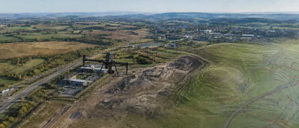
Aerial drone surveying uses remotely operated aircraft to capture photographs, video and measured data from above. It can provide an efficient way to record land, buildings, infrastructure and other features that may be difficult, hazardous or time-consuming to survey from ground level.
Depending on the project requirements, drone survey data can be processed into orthomosaic imagery, three-dimensional point clouds, digital terrain models, surface models, contours, volume calculations and topographical survey information.
This guide explains how aerial drone surveying works, its main benefits and limitations, the outputs that can be produced and the types of projects for which it is most suitable.
What Is Aerial Drone Surveying?
Aerial drone surveying is the collection of site information using an unmanned aircraft fitted with a camera, LiDAR sensor or another specialist payload.
The drone is flown over or around the survey area using a planned flight path. During the flight, it records overlapping photographs, video footage or laser measurements of the visible surfaces below.
The captured data can then be processed and combined with positioning information to create a measured representation of the site.
Aerial drone surveying may be used as a standalone method for certain inspection and mapping projects. For more detailed surveys, it is often combined with ground-based observations made using GNSS equipment, total stations or terrestrial laser scanners.
How Does Aerial Drone Surveying Work?
The exact surveying method depends on the site, required outputs, accuracy specification and type of sensor being carried by the drone.
A typical aerial drone survey involves the following stages.
1. Reviewing the Survey Brief
The surveyor first establishes what information the client needs and how the finished data will be used.
This includes reviewing:
- The site location and survey boundary
- The size and shape of the area
- The required drawings, models or imagery
- The required accuracy and level of detail
- The project coordinate system and datum
- Access arrangements
- Nearby buildings, roads and people
- Airspace and operational restrictions
- The required completion programme
A clear brief is important because a photographic inspection, a measured topographical survey and a volume calculation require different flight and processing methods.
2. Site and Airspace Assessment
Before the flight, the operator assesses whether the work can be carried out safely and legally.
The assessment may consider:
- Restricted or controlled airspace
- Nearby airports or aerodromes
- Residential, commercial or industrial areas
- Roads and public access
- Overhead cables and structures
- Trees and other obstacles
- Suitable take-off and landing areas
- Weather and visibility
- The presence of uninvolved people
Some sites may require additional permissions, coordination or a different method of operation.
3. Establishing Survey Control
Where measured mapping outputs are required, survey control points or independent check points may be established on the ground.
These points provide known positions and levels against which the aerial data can be aligned and checked. They can also allow the finished survey to be supplied in an agreed coordinate system.
The amount of ground control required depends on the equipment, processing method, site conditions and accuracy specification.
4. Planning and Flying the Survey
For mapping work, the drone normally follows a series of planned flight lines across the site.
Factors such as flying height, flight speed, image overlap and camera angle are selected to suit the required coverage and resolution.
Where building elevations, roofs or structures are being recorded, additional angled or close-range imagery may also be required.
The operator monitors the aircraft, surrounding airspace, battery condition and image or sensor capture throughout the flight.
5. Processing and Checking the Data
After the flight, the captured data is transferred into specialist processing software.
Overlapping photographs may be processed using photogrammetry to calculate the three-dimensional position of visible features. LiDAR observations may be combined with positioning and orientation information to produce a measured point cloud.
The resulting data is checked for coverage, alignment, quality and consistency before the required drawings, models or imagery are prepared.
What Technology Is Used for Aerial Drone Surveys?
Different sensors and positioning systems can be used depending on the survey requirements.
High-Resolution Cameras
High-resolution cameras are used to capture aerial photographs and overlapping survey imagery.
The photographs may be supplied individually for inspection purposes or processed into measured mapping and three-dimensional models.
Drone Photogrammetry
Photogrammetry uses multiple overlapping photographs taken from different positions to calculate surface geometry.
It works best where the surveyed surfaces are clearly visible, have sufficient visual texture and can be photographed from suitable angles.
Photogrammetry can produce detailed colour imagery and textured three-dimensional models, making it useful for mapping, visualisation, building recording and progress monitoring.
Aerial LiDAR
LiDAR measures distance using laser pulses rather than calculating geometry solely from photographs.
It can be useful for recording terrain, vegetation, buildings and other surfaces, particularly where some laser pulses can pass through gaps in vegetation and reach the ground below.
More information about this method is available in our guide to aerial LiDAR surveys.
GNSS and Inertial Positioning
Survey drones may use Global Navigation Satellite System positioning and inertial measurement equipment to record the position and orientation of the aircraft during the flight.
Some systems use real-time or post-processed corrections to improve the positional quality of the captured data.
Typical Aerial Drone Survey Outputs
The outputs supplied from aerial drone surveying depend on the project brief and the method used to capture the site.
Aerial Photographs
High-resolution photographs can provide a detailed visual record of roofs, structures, construction sites, land and other visible features.
Images may be supplied individually or organised by location and viewing direction.
Aerial Video
Video footage can provide an overview of a site, building or route and may be useful for inspections, marketing, project records and progress reporting.
Video is primarily a visual output and should not automatically be treated as measured survey information.
Orthomosaic Imagery
An orthomosaic is a collection of aerial photographs processed and corrected to create a single plan-view image.
Unlike an ordinary aerial photograph, an orthomosaic is adjusted to reduce the effects of camera perspective and terrain variation. When produced to an appropriate survey specification, it can be used as a measured base image for planning, mapping and site assessment.
Three-Dimensional Point Clouds
A point cloud is a collection of measured three-dimensional positions representing visible surfaces across the survey area.
Point clouds may show:
- Terrain
- Buildings
- Roofs
- Roads and tracks
- Vegetation
- Structures
- Stockpiles and earthworks
The data can be viewed, measured and used as source information for further drawings and models.
Digital Surface Models
A digital surface model represents the upper visible surface of the site, including terrain, buildings, trees and other objects above ground level.
It may support height analysis, visualisation, planning and environmental assessment.
Digital Terrain Models
A digital terrain model represents the underlying ground surface after buildings, vegetation and other above-ground features have been removed or classified from the dataset.
Terrain models may be used for contour generation, drainage assessment, route planning, earthworks design and flood modelling.
Topographical Survey Information
Aerial data can be used alongside ground survey observations to produce topographical survey drawings.
Depending on the specification, these may show:
- Ground levels
- Contours
- Buildings
- Roads and tracks
- Walls and visible boundaries
- Vegetation
- Earthworks
- Other agreed surface features
Features hidden by trees, vehicles, roofs, overhangs or other obstructions may still require ground-based measurement.
Three-Dimensional Mesh Models
Photogrammetric data can be processed into a three-dimensional surface mesh with photographic texture applied to it.
These models may support visualisation, design coordination, heritage recording and condition assessment.
Contour and Level Information
Contours and spot levels can be generated from an appropriate terrain model.
The contour interval and displayed detail should reflect the quality of the source data, the terrain and the intended use of the survey.
Volume Calculations
Aerial drone surveying can be used to calculate volumes for stockpiles, quarries, earthworks and other visible surfaces.
Repeat surveys can also be compared to assess changes in material quantities or ground levels over time.
Benefits of Aerial Drone Surveying
Efficient Coverage
A drone can record a substantial area more quickly than many ground-based surveying or inspection methods.
This can be particularly useful for large sites, agricultural land, quarries, infrastructure routes and construction projects.
Improved Access
Drones can capture information from roofs, tall structures, steep ground and other areas that may be difficult to observe safely from ground level.
This can reduce the need for ladders, scaffolding or other temporary access arrangements during an initial visual inspection.
Reduced Exposure to Hazards
Aerial data collection can reduce the time surveyors need to spend close to unstable structures, steep slopes, working quarries, busy construction areas or other hazards.
It does not remove the need for appropriate safety planning, but it can limit unnecessary exposure.
Detailed Site Records
Drone surveys can produce a detailed visual and three-dimensional record of site conditions at a particular date.
The data can be retained for design, inspection, progress monitoring and comparison with later surveys.
Repeatable Monitoring
Similar flight plans can be repeated at agreed intervals to record how a site changes over time.
This may support:
- Construction progress monitoring
- Earthworks assessment
- Stockpile measurement
- Quarry monitoring
- Coastal change assessment
- Vegetation monitoring
- Condition inspections
Multiple Outputs from One Survey
A well-planned flight may provide source data for photographs, orthomosaic imagery, point clouds, surface models, contour information and other outputs.
However, the required deliverables should be identified before the survey because the flight method needed for one output may not be suitable for another.
Limitations of Aerial Drone Surveying
Aerial drone surveying is not the best solution for every site or every measurement requirement.
Only Visible Surfaces Can Be Recorded
Drone cameras and sensors can only record surfaces visible or reachable from the air.
They cannot reliably capture:
- Building interiors
- Features beneath solid roofs
- Objects hidden by parked vehicles
- Underground services
- Detail beneath dense obstructions
- Surfaces hidden beneath overhangs
Weather Restrictions
Strong wind, rain, poor visibility and unsuitable lighting can delay or prevent drone operations.
Weather may also affect image quality, surface appearance and the completeness of the processed data.
Airspace and Operational Restrictions
Flights must comply with current aviation requirements and be planned around the aircraft, location, people, airspace and proposed method of operation.
The operator may need suitable registration, remote-pilot competency, insurance, permissions or an Operational Authorisation depending on the circumstances.
The UK Civil Aviation Authority’s drone guidance provides current information about registration, operating categories, airspace rules and more advanced operations.
Vegetation and Obstructions
Photogrammetry records the visible top surface of vegetation rather than automatically revealing the ground below.
LiDAR may obtain some ground returns through gaps in vegetation, but dense coverage can still prevent complete measurement.
Ground Detail May Still Be Required
Drainage covers, kerb details, thresholds, boundaries and other small or obscured features may require direct ground measurement.
A combined aerial and ground-survey approach often provides the most complete result.
Common Applications of Aerial Drone Surveying
Land and Topographical Surveys
Aerial drone surveying can provide terrain and surface information for planning, engineering, design and development projects.
Construction Progress Monitoring
Regular flights can provide dated visual records and measured datasets showing how a construction site develops over time.
Roof and Building Inspections
High-resolution photographs can help identify visible defects, damaged coverings, blocked gutters and other external building conditions.
A drone inspection is visual and does not by itself confirm structural integrity. Specialist investigation may still be required.
Quarries, Stockpiles and Earthworks
Three-dimensional surface data can support volume calculations, material monitoring and comparisons between survey dates.
Highways and Infrastructure
Drones can help record roads, bridges, embankments, cuttings, structures and surrounding terrain, subject to the operational restrictions of the site.
Heritage Buildings and Historic Sites
Aerial imagery and three-dimensional models can provide a detailed record of roofs, facades and landscape features that may be difficult to view from the ground.
Agriculture and Land Management
Aerial imagery can support land inspection, crop monitoring, drainage assessment and the identification of visible changes across fields.
Coastal and Environmental Monitoring
Repeat surveys can be used to assess visible changes in coastlines, river corridors, erosion, vegetation and ground surfaces.
Property and Site Marketing
Aerial photographs and video can provide an overview of development sites, commercial property and surrounding land.
Marketing photography should be planned separately from measured survey work where the required styles and flight paths differ.
How Accurate Is Aerial Drone Surveying?
There is no single accuracy figure that applies to every drone survey.
The result depends on factors including:
- The type and quality of the sensor
- The flying height
- The camera angle
- The image overlap
- The positioning system
- The survey-control arrangement
- The terrain and vegetation
- Weather and lighting
- The processing method
- The quality of the independent checks
The required accuracy should be agreed before the survey is planned. This allows the operator to select an appropriate aircraft, sensor, flight plan, control method and processing workflow.
A drone photograph should not automatically be assumed to constitute an accurate measured survey. The collection and checking method must be appropriate for the intended use of the data.
Aerial Drone Surveying Compared with Ground Surveying
Aerial and ground-based surveying methods have different strengths.
Drones are effective for recording visible surfaces across large areas and for capturing roofs, terrain and elevated structures. Ground survey equipment is generally better suited to small features, obscured detail, precise identification and areas that cannot be seen from the air.
Ground surveying may still be required where:
- Precise boundary positions must be established
- Drainage covers and service features must be recorded
- Thresholds and finished-floor levels are required
- Features are hidden beneath trees or vehicles
- Detailed vertical faces must be measured
- Independent survey checks are required
For many projects, the most effective solution is to combine aerial data with targeted ground observations.
How Much Does an Aerial Drone Survey Cost?
The cost of aerial drone surveying depends on the size, location and complexity of the project.
Factors affecting the fee may include:
- The size of the survey area
- The required outputs
- The required accuracy
- The site location
- Airspace restrictions
- The aircraft and sensor required
- The amount of ground control
- Site access and operational constraints
- The amount of processing and drawing work
- The required delivery programme
A simple photographic inspection may cost substantially less than a fully controlled aerial mapping survey producing point clouds, terrain models and CAD drawings.
What Information Is Needed for a Quotation?
To prepare an accurate quotation, it is helpful to provide:
- The site address or location
- A clearly marked survey boundary
- The approximate site area
- The intended use of the survey
- The required photographs, drawings or models
- The required accuracy
- The required coordinate system and datum
- The preferred file formats
- The required completion date
- Known access or airspace restrictions
Providing this information allows the survey method and deliverables to be designed around the actual project requirements.
Frequently Asked Questions About Aerial Drone Surveying
Can a drone produce an accurate topographical survey?
Yes, where the flight, survey control, equipment and processing method are suitable for the required accuracy. Ground observations may still be needed for obscured or small features.
Can drones survey beneath trees?
Ordinary aerial photography records the visible tree canopy rather than the ground below. Aerial LiDAR may record some ground points through gaps in vegetation, although dense vegetation can still limit coverage.
Can drones survey building interiors?
Not as part of a normal external aerial survey. Internal measured surveys generally require terrestrial laser scanning or other ground-based measurement.
Can drone surveys take place in all weather?
No. Strong wind, rain, poor visibility and other unsuitable conditions may prevent a safe flight or reduce the quality of the captured data.
Does a commercial drone operator need insurance?
Commercial drone operations require appropriate third-party insurance. The operator must also meet the registration, competency and operational requirements applicable to the proposed flight.
Can drone surveys replace scaffolding?
A drone may reduce the need for scaffolding during an initial visual inspection. It cannot replace physical access where touching, testing, repair or close specialist investigation is required.
Aerial Drone Surveying from Pinpoint Mapping
Pinpoint Mapping provides aerial drone surveying and associated mapping services for projects across Bristol, Bath and the South West.
Depending on the survey brief, services and outputs may include:
- High-resolution aerial photography
- Aerial video
- Orthomosaic imagery
- Three-dimensional point clouds
- Digital terrain models
- Digital surface models
- Contours and level information
- Topographical survey drawings
- Volume calculations
- Construction progress records
- Building and roof inspection imagery
Each project is assessed individually so that the proposed aircraft, survey method, accuracy and deliverables are appropriate for the site and intended use.
Request an Aerial Drone Survey Quotation
To request a quotation, send us the site location, survey boundary, required outputs and any available project specification.
Contact Pinpoint Mapping by telephone or email, or use the Request a Quote form on our website. We will review the information and provide a quotation based on the required scope of the aerial drone survey.